Mapping Drones
UAVisus D5000
UAVisus D5000
UAVisus D5000

The D5000 is a high-performance UAV with precise GNSS for control-free mapping, modular payloads like LiDAR and thermal imaging, and advanced ToF sensors for terrain-following and obstacle avoidance. It offers long endurance, redundant systems, and reliable performance, supported by integrated software and cloud services for efficient data processing.
Uavisus V500
UAVisus D5000
UAVisus D5000

The V500 is a lightweight, high-precision, long-endurance electric VTOL fixed-wing drone. It excels in efficient data collection, control point-free mapping, and portability. Built with Kevlar and PMI composite materials, it maximum weighs only 7.5kg and can fly for up to 180 minutes. The modular design allows quick assembly and improved efficiency. The V500 comes in three configurations: orthophoto and oblique photography, Phase One versions, meeting diverse customization needs.
Payloads
D-CAM3000
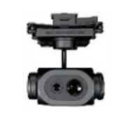
D-TIRV1100
D-CAM3000

D-OP5000
D-TIRV1100
D-CAM3000
D-TIRV1100
D-TIRV1100
D-TIRV1100
D-LiDAR550
DV-LiDAR660
D-TIRV1100
D-LiDAR800
DV-LiDAR660
DV-LiDAR660
DV-LiDAR660
DV-LiDAR660
DV-LiDAR660
DV-LiDAR15
DV-LiDAR15
DV-LiDAR15
DV-LiDAR30
DV-LiDAR15
DV-LiDAR15
DV-LiDAR40
DV-LiDAR15
DV-LiDAR40

GEOSPATIAL & IMAGE MAPPING
UAVisus is the go-to partner for oil and gas utilities seeking to map, model, and effectively manage their assets. Offering end-to-end geospatial services, we provide the geographic insights needed to drive business success.
AIRBORNE LIDAR MAPPING
Airborne LiDAR data provides location and elevation information that defines the surface of the earth and the heights of above-ground features. With a suite of LiDAR sensors and advanced processing and production techniques, UAVisus is an innovation technology promoter in the LiDAR industry.